WEATHER WATCH: Rain chances increasing for Friday
Published 6:33 pm Thursday, March 27, 2025
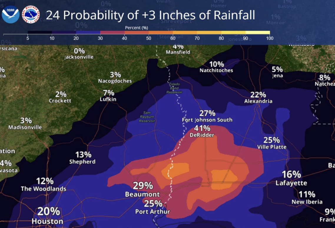
An active weather pattern taking shape today will bring increasing rain chances across Southwest Louisiana Friday afternoon.
An upper-level disturbance crossing Texas will combine with a nearly stationary front near the Texas coast to produce widespread showers and storms. This disturbance will move across southeast Texas into Louisiana Friday into Saturday.
Multiple rounds of showers and storms are expected with heavy rainfall and a few severe storms possible, according to the National Weather Service’s Lake Charles office.
Trending
There is a slight risk for excessive rainfall into Friday night with a marginal risk of large hail and damaging wind gusts the likeliest threats.
The rainfall is expected to arrive at about noon on Friday and last through about 6 p.m. Saturday.
Conditions will be favorable for flooding. Widespread rainfall amounts are expected from 1 to 3 inches.
Isolated locations could receive up to 4 to 5 inches.
Severe storms will again be possible late Sunday into Monday with another disturbance that will move through the region. Showers and storms will develop along and ahead of the front, with a few storms capable of producing severe weather from late Sunday into early Monday.
Trending


-
eEdition
-
-
