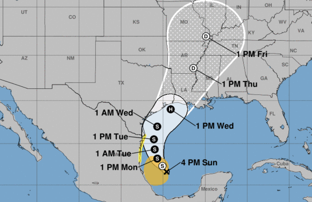
WEATHER UPDATE: Storm expected to make landfall along southeast Texas, SW La. coastline
Published 7:11 pm Sunday, September 8, 2024
A tropical disturbance in the southern Gulf of Mexico is expected to develop into a tropical storm over the next 24-48 hours.
National Weather Service Lake Charles Meteorologist Donald Jones said while the system does have tropical storm-force winds already, it does not have a closed center of circulation.
“This is more of an elongated area of low pressure, but it’s beginning to gain that circulation and that will likely happen in the next 24-48 hours,” Jones said. “At that point, it would become a tropical storm.”
The storm is expected to move north over the next few days with landfall expected along the southeast Texas or Louisiana coastline on Wednesday.
Jones said based on the current forecast track, tropical storm-force wind, storm surge, heavy rainfall and tornadoes will also be possible across southeast Texas and Southwest Louisiana.
The storm is expected to make landfall as a Category 1 hurricane.
“This storm is going to get caught up in the cold front that came into the area yesterday and that’s what’s going to help it push off to the northeast,” Jones said. “It’s only moving toward the coast at 5 mph — and that will continue over the next couple of days — but once it hits that cold front, it’s going to accelerate. This won’t be a storm that stalls for days and days and days.”
Jones said the area will be dealing with the outer rain bands from the storm for a couple of days, beginning Tuesday.
There is a 30-40 percent chance of seeing tropical storm-force winds across Southwest Louisiana.
“These probabilities will change should the forecast track or intensity change,” Jones said.


