UPDATE: Going to be ‘a while’ before winds die down across SW La.
Published 5:34 pm Monday, July 8, 2024
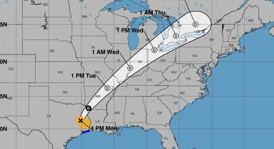
The first hurricane of the season, Hurricane Beryl, made landfall early Monday morning near Matagorda, Texas, with maximum sustained winds of 80 mph.
By mid-afternoon it had been downgraded to a tropical storm with its remnants continuing to turn northeast.
“As it moves across east Texas, we’re going to be looking at quite a bit of rainfall,” said Donald Jones, a meteorologist with the National Weather Service’s Lake Charles office. “Beryl should be in Arkansas by Tuesday afternoon and then southeast Missouri.”
Jones said Southwest Louisiana could experience a low-end flash flood risk as the lingering rainbands associated with Beryl continue to produce periods of heavy rain.
“We’re expecting one of those rainbands to set up somewhere across either Southwest, southeast, maybe central Louisiana and linger,” Jones said. “Rainfall totals of 2 to 4 inches are expected across Southwest Louisiana through Tuesday. Higher amounts will be possible in narrow areas should long duration of rainbands develop.”
The Louisiana Department of Transportation and Development issued warnings Monday afternoon of water on highways across the region. In Cameron, Davis and Wakefield roads were holding water; in Creole, Little Chenier Road was affected; in Grand Chenier, warnings were issued for Mermentau River Road; and in Klondike, North Drake and Les Rois roads were affected.