Warm front set to move into area Sunday
Published 5:30 pm Saturday, March 25, 2023
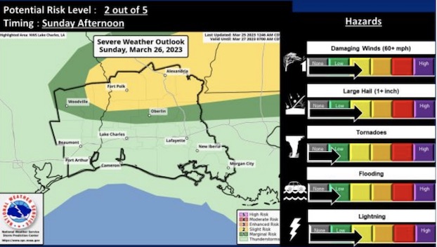
The potential for severe weather on Sunday has increased in Southwest Louisiana, mainly for areas north of the U.S. 190 corridor.
A warm front will move north into the forecast area by Sunday afternoon, said Joe Rua, lead forecaster of the National Weather Service’s Lake Charles office.
“Scattered showers and thunderstorms are expected to develop by noon time ahead of the warm front,” Rua said. “Conditions will be favorable that thunderstorms that develop will have the potential to produce large hail and damaging straightline downburst winds.”
He said a quick spin-up tornado with storms right along the frontal boundary cannot be ruled out.
The severe potential is expected to decrease after sunset, Rua said.


