Benefit to city a factor in annexation decisions
Published 4:08 pm Monday, November 20, 2017
Are there any plans to annex the properties along the La. 14 East, Corbina Road and Gauthier Road areas?
Mike Huber, Lake Charles planning director, didn’t address the question directly but said annexation happens via private request or via action by the city.
Trending
Officials consider requests as they’re submitted and may seek annexation if the city will benefit or if the land is needed to accommodate population growth, Huber said.
“Annexation may be justified where there is economic benefit to the city, such as a planned retail development which may be a long-term revenue source or in large projects where sales tax on materials may fund extension of services,” he said in a statement forwarded to The Informer.
“It is the norm for city boundaries to expand to support population growth. Past experience has shown that staying ahead of growth can reduce overall costs for extension of services. For this reason, expansion of boundaries before growth occurs can be advantageous and can control long-term costs to the city.”
For more information, visit www.cityoflakecharles.com.
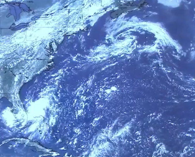
Needed storm force wanes at equator
If a hurricane forms in the Northern Hemisphere, could it cross the equator into the Southern Hemisphere? If it did, would its direction of rotation change? Has this ever happened?
It’s possible for a hurricane to cross the equator, but scientists have no record of one ever doing so, said Andy Patrick, meteorologist-in-charge at the local National Weather Service office.
Trending
Tropical cyclones generally don’t form within 5 degrees of the equator, where the Coriolis force, which imparts spin to storms, is zero. A few storms have come within that range — a proximity that usually weakens or deflects them — in the last 50 years, but they never crossed the line.
From a September 2007 Informer column:
A tropical depression formed in the Western Pacific at 1.7 degrees north latitude on March 21, 1956, but it didn’t become a typhoon until it reached 3.3 degrees north latitude — just over 200 miles from the equator — three days later. The storm, Typhoon Sarah, traveled as far north as 15.8 degrees before it looped east and south and petered out at 11.2 degrees on April 5.
Converging weather systems, their winds made cyclonic by the surrounding land, conspired in late December 2001 to create Typhoon Vamei, which developed near Singapore at 1.5 degrees north latitude, or just over 100 miles from the equator. The circulating clouds of the storm, which never exceeded Category 1 strength, crossed the equator, but the center of the system never did. Vamei later moved over Sumatra, briefly reorganized into a tropical storm, and eventually dissipated in the Indian Ocean, torn apart by wind shear just above 5 degrees north latitude.
Three years later, a tropical depression formed in the Indian Ocean at 1.6 degrees north latitude and traveled south, becoming a tropical storm at 0.7 degrees — a mere 50 or so miles from the equator.
Its circulation, like Vamei’s, crossed the equator. The storm, later named Cyclone Agni, traveled northwest and then southwest, dissipating over Somalia less than a week after it formed. It never became stronger than a Category 1 storm.
“It was noted that clockwise rotation was developing in the Southern Hemisphere with Agni while it was just north of the equator,” Patrick wrote Thursday in an email.
“Tropical cyclones rotate in a counterclockwise direction in the Northern Hemisphere. It’s difficult to say whether a center of circulation could be sustained after crossing the equator.”
For more information, visit www.weather.gov/lch.