UPDATE: Beryl’s track shifting more north, SW La. may feel some impacts
Published 9:12 pm Friday, July 5, 2024
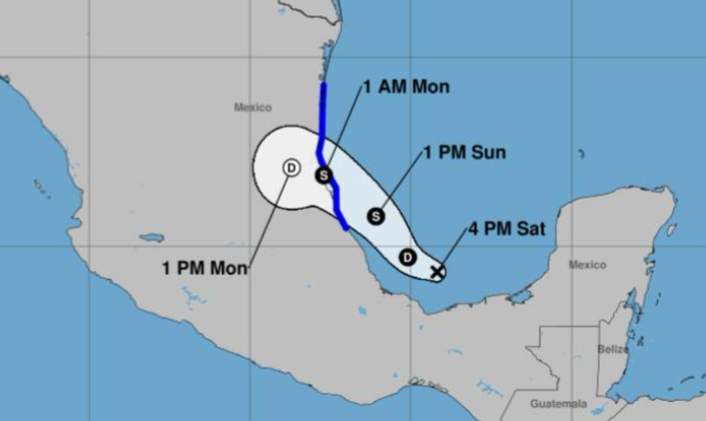
Just a month into the 2024 hurricane season, Southwest Louisiana now finds itself in the cone of uncertainty as now-Tropical Storm Beryl starts making its way toward the United States.
Right now it is forecast to strike Corpus Christi, Texas, on Monday as a Category 1 hurricane.
“That’s close enough to our area that I felt we needed to discuss it,” said Donald Jones, a meteorologist with the National Weather Service Lake Charles office. “It wouldn’t be out of the realm of possibility for us to be under a tropical storm advisory if it shifts any more to the north.”
Jones said Beryl has lessened in strength as it makes its way across Mexico’s Yucatan Peninsula. It is expected to intensify when it hits the Gulf of Mexico.
“It’s going to take about 24 hours for it to reorganize after it leaves the Yucatan Peninsula,” Jones said. “But I don’t expect rapid intensification with this storm.”
A hurricane watch and a storm surge watch is in effect along the Texas coast from the mouth of the Rio Grande northward to Sargent, meaning hurricane conditions are expected within 36 hours.
Jones said he does foresee Beryl continuing to shift north, but said chances are very low it will land near the Texas-Louisiana border.
He said Southwest Louisiana has about a 5-10 percent chance of seeing tropical storm-force winds when Beryl hits land, most likely Monday morning.
A storm surge of about 3 feet and minor coastal flooding could also occur in the area.
“If you had problems with Alberto, you’ll probably have the same problems with Beryl in regards to coastal flooding,” Jones said.


