It’s gonna be hot today, tomorrow
Published 10:38 am Wednesday, July 3, 2024
The forecast track of Hurricane Beryl has the storm making landfall across northern Mexico on Sunday.
Based on this track, the only impacts across southeast Texas or Southwest Louisiana would be minor coastal flooding, said Donald Jones, a meteorologist with the National Weather Service’s Lake Charles office.
“However, additional impacts could occur should Beryl track further north than presently indicated,” he said.
Trending
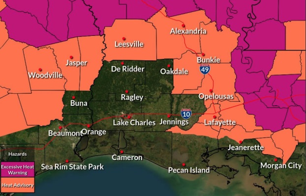
As for now in Southwest Louisiana, temperatures are expected in the mid-90s today and Thursday. The heat indices today are expected to be as high as 112 degrees from 11 a.m. until 7 p.m.; on Thursday, it’s expected to be as high as 110 degrees.
A heat advisory is again in effect for interior Southeast Texas and central Louisiana.
Showers and thunderstorms are expected to spread across the area later this week in response to a cold front approaching Southwest Louisiana.
“A weak boundary approaching the area Saturday will produce heavy rain producing thunderstorms that will have a marginal probability of flash flooding,” Jones said. “At present, this activity is unrelated to Beryl.”