Weak cold front will arrive tomorrow with a bit of a reprieve for heat-weary area
Published 1:15 pm Monday, August 14, 2023
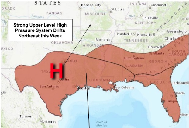
A slight bit of rest is in store for a heat-weary Southwest Louisiana as a weak cold front is expected to move into the region Tuesday, allowing temperatures and humidity to fall slightly through Wednesday.
Relative humidity is expected to dip in the 20% range generally north of Interstate 10 during that time period.
Isolated to scattered storms may occur with the weak front, but the potential rainfall is not anticipated to be significant and is expected to worsen drought conditions and bring about an increased fire danger risk, the National Weather Service’s Lake Charles office reported.
The cooler weather isn’t expected to last long with heat building up again later in the week. Triple-digit temperatures are expected to return on Thursday. The heat index values will be above 110 degrees with south winds around 10 to 15 mph.
With this very hot, humid, and sunny weather residents are advised to take the proper heat safety precautions. Heat stroke can cause death or permanent disability if emergency treatment is not given. Residents are advised to avoid strenuous activity and prolonged time outside, take frequent breaks in the shade or air conditioning, and drink plenty of water. Do not leave children or pets in vehicles.
NWS-LC said the tropics continue to be quiet with no tropical activity is expected over the next seven days.